
下院沟 topographic map
Interactive map
Click on the map to display elevation.
About this map
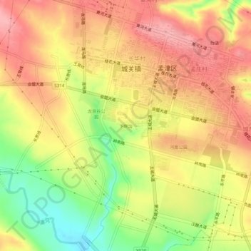
Name: 下院沟 topographic map, elevation, terrain.
Location: 下院沟, 城关镇, 孟津区, 洛阳市, 孟津区, 河南省, 471100, 中国 (34.79771 112.41025 34.83771 112.45025)
Average elevation: 313 m
Minimum elevation: 242 m
Maximum elevation: 361 m
Other topographic maps
Click on a map to view its topography, its elevation and its terrain.