
湖墅街道 topographic map
Interactive map
Click on the map to display elevation.
About this map
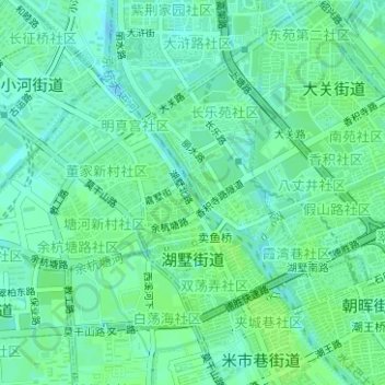
Name: 湖墅街道 topographic map, elevation, terrain.
Location: 湖墅街道, 拱墅区, 杭州市, 浙江省, 中国 (30.29121 120.13585 30.30944 120.14952)
Average elevation: 11 m
Minimum elevation: 5 m
Maximum elevation: 15 m
Other topographic maps
Click on a map to view its topography, its elevation and its terrain.