
杨暴村 topographic map
Interactive map
Click on the map to display elevation.
About this map
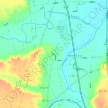
Name: 杨暴村 topographic map, elevation, terrain.
Location: 杨暴村, 长治市, 山西省, 中国 (36.16469 112.98851 36.20469 113.02851)
Average elevation: 916 m
Minimum elevation: 901 m
Maximum elevation: 942 m
Other topographic maps
Click on a map to view its topography, its elevation and its terrain.