
翟店街道 topographic map
Interactive map
Click on the map to display elevation.
About this map
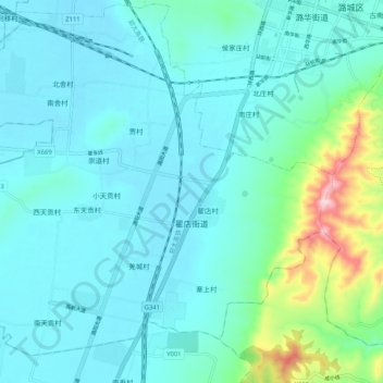
Name: 翟店街道 topographic map, elevation, terrain.
Location: 翟店街道, 潞城区, 长治市, 山西省, 中国 (36.25131 113.11487 36.33297 113.21806)
Average elevation: 969 m
Minimum elevation: 907 m
Maximum elevation: 1,306 m
Other topographic maps
Click on a map to view its topography, its elevation and its terrain.