
光村镇 topographic map
Interactive map
Click on the map to display elevation.
About this map
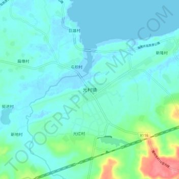
Name: 光村镇 topographic map, elevation, terrain.
Location: 光村镇, 儋州市, 海南省, 中国 (19.78005 109.43715 19.86005 109.51715)
Average elevation: 15 m
Minimum elevation: -5 m
Maximum elevation: 93 m
Other topographic maps
Click on a map to view its topography, its elevation and its terrain.