
愉景灣 topographic map
Interactive map
Click on the map to display elevation.
About this map
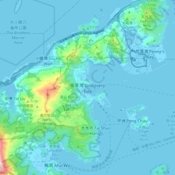
Name: 愉景灣 topographic map, elevation, terrain.
Location: 愉景灣, 離島區, 新界, 香港, 中国 (22.25977 113.97627 22.33977 114.05627)
Average elevation: 59 m
Minimum elevation: -4 m
Maximum elevation: 620 m
Other topographic maps
Click on a map to view its topography, its elevation and its terrain.