
灰窰下 topographic map
Interactive map
Click on the map to display elevation.
About this map
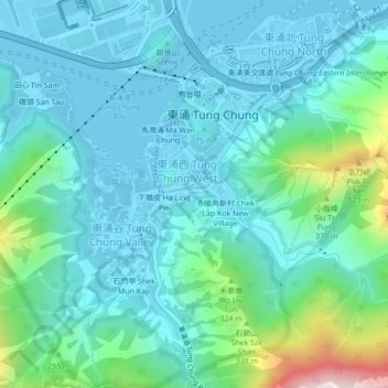
Name: 灰窰下 topographic map, elevation, terrain.
Location: 灰窰下, 東涌, 離島區, 新界, 香港, 中国 (22.25862 113.91850 22.29862 113.95850)
Average elevation: 135 m
Minimum elevation: -6 m
Maximum elevation: 763 m