
南丫島 topographic map
Interactive map
Click on the map to display elevation.
About this map
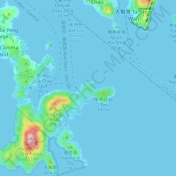
Name: 南丫島 topographic map, elevation, terrain.
Location: 南丫島, 榕樹塱村, 離島區, 新界, 香港, 中国 (22.17774 114.10242 22.24116 114.16042)
Average elevation: 19 m
Minimum elevation: -5 m
Maximum elevation: 325 m