
桃源街道 topographic map
Interactive map
Click on the map to display elevation.
About this map
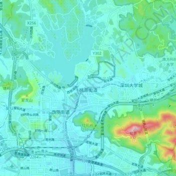
Name: 桃源街道 topographic map, elevation, terrain.
Location: 桃源街道, 南山区, 深圳市, 广东省, 518000, 中国 (22.55632 113.94997 22.62906 114.02131)
Average elevation: 56 m
Minimum elevation: -4 m
Maximum elevation: 400 m
Other topographic maps
Click on a map to view its topography, its elevation and its terrain.