
白沙县 topographic map
Interactive map
Click on the map to display elevation.
About this map
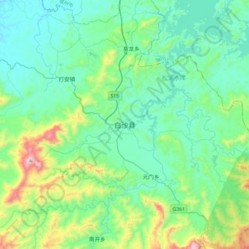
Name: 白沙县 topographic map, elevation, terrain.
Location: 白沙县, 白沙黎族自治县, 海南省, 中国 (19.06625 109.28751 19.38625 109.60751)
Average elevation: 334 m
Minimum elevation: 103 m
Maximum elevation: 1,296 m
Other topographic maps
Click on a map to view its topography, its elevation and its terrain.