
甘棠镇 topographic map
Interactive map
Click on the map to display elevation.
About this map
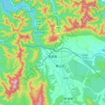
Name: 甘棠镇 topographic map, elevation, terrain.
Location: 甘棠镇, 黄山区, 黄山市, 安徽省, 242700, 中国 (30.23166 118.04684 30.37141 118.18778)
Average elevation: 301 m
Minimum elevation: 102 m
Maximum elevation: 806 m
Other topographic maps
Click on a map to view its topography, its elevation and its terrain.