
谭家桥镇 topographic map
Interactive map
Click on the map to display elevation.
About this map
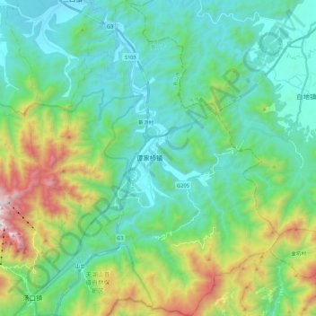
Name: 谭家桥镇 topographic map, elevation, terrain.
Location: 谭家桥镇, 黄山区, 黄山市, 安徽省, 中国 (30.07356 118.20425 30.25847 118.35410)
Average elevation: 544 m
Minimum elevation: 159 m
Maximum elevation: 1,770 m
Other topographic maps
Click on a map to view its topography, its elevation and its terrain.