
Catonsville topographic map
Interactive map
Click on the map to display elevation.
About this map
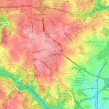
Name: Catonsville topographic map, elevation, terrain.
Average elevation: 104 m
Minimum elevation: 10 m
Maximum elevation: 170 m
Other topographic maps
Click on a map to view its topography, its elevation and its terrain.
Soldiers Delight Natural Environment Area
United States > Maryland > Baltimore County > Owings Mills
Average elevation: 187 m
Bowleys Quarters
United States > Maryland > Baltimore County > Bowleys Quarters
Average elevation: 2 m