
黑马河乡 topographic map
Interactive map
Click on the map to display elevation.
About this map
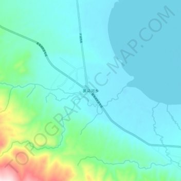
Name: 黑马河乡 topographic map, elevation, terrain.
Location: 黑马河乡, 共和县, 海南藏族自治州, 青海省, 中国 (36.68969 99.73740 36.76969 99.81740)
Average elevation: 3,276 m
Minimum elevation: 3,188 m
Maximum elevation: 3,750 m
Other topographic maps
Click on a map to view its topography, its elevation and its terrain.