
乌拉山镇 topographic map
Interactive map
Click on the map to display elevation.
About this map
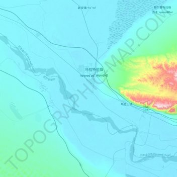
Name: 乌拉山镇 topographic map, elevation, terrain.
Location: 乌拉山镇, 乌拉特前旗, 巴彦淖尔市, 内蒙古自治区, 014400, 中国 (40.55843 108.43947 40.83160 108.90267)
Average elevation: 1,064 m
Minimum elevation: 1,016 m
Maximum elevation: 1,699 m
Other topographic maps
Click on a map to view its topography, its elevation and its terrain.