
Thank you for supporting this site ❤️
Make a donation
Make a donation
São Romão topographic map
Click on the map to display elevation.
Thank you for supporting this site ❤️
Make a donation
Make a donation
About this map
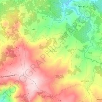
Name: São Romão topographic map, elevation, terrain.
Location: São Romão, Armamar, Viseu, 5110-122, Portugal (41.07026 -7.72830 41.11026 -7.68830)
Average elevation: 680 m
Minimum elevation: 482 m
Maximum elevation: 851 m
Thank you for supporting this site ❤️
Make a donation
Make a donation
Other topographic maps
Click on a map to view its topography, its elevation and its terrain.
Thank you for supporting this site ❤️
Make a donation
Make a donation