
Thank you for supporting this site ❤️
Make a donation
Make a donation
Queimada topographic map
Click on the map to display elevation.
Thank you for supporting this site ❤️
Make a donation
Make a donation
About this map
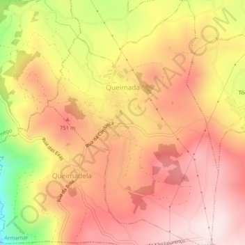
Name: Queimada topographic map, elevation, terrain.
Location: Queimada, Armamar, Viseu, 5110-401, Portugal (41.08028 -7.74881 41.10983 -7.72149)
Average elevation: 669 m
Minimum elevation: 304 m
Maximum elevation: 846 m
Thank you for supporting this site ❤️
Make a donation
Make a donation
Other topographic maps
Click on a map to view its topography, its elevation and its terrain.