
Schwemmpfuhl topographic map
Interactive map
Click on the map to display elevation.
About this map
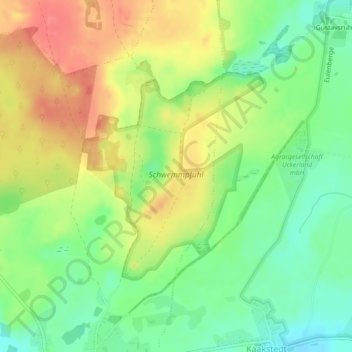
Name: Schwemmpfuhl topographic map, elevation, terrain.
Average elevation: 69 m
Minimum elevation: 38 m
Maximum elevation: 103 m
Other topographic maps
Click on a map to view its topography, its elevation and its terrain.
Pinnow
Deutschland > Brandenburg > Uckermark > Gerswalde
Pinnow, Gerswalde, Uckermark, Brandenburg, Deutschland
Average elevation: 60 m