
Pinnow topographic map
Interactive map
Click on the map to display elevation.
About this map
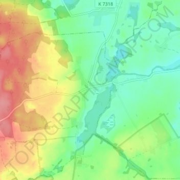
Name: Pinnow topographic map, elevation, terrain.
Location: Pinnow, Gerswalde, Uckermark, Brandenburg, Deutschland (53.19392 13.76757 53.23392 13.80757)
Average elevation: 60 m
Minimum elevation: 27 m
Maximum elevation: 110 m
Other topographic maps
Click on a map to view its topography, its elevation and its terrain.
Schwemmpfuhl
Deutschland > Brandenburg > Uckermark > Gerswalde
Schwemmpfuhl, Buchholzer Straße, Gerswalde, Uckermark, Brandenburg, 17268, Deutschland
Average elevation: 69 m