
沙石多乡 topographic map
Interactive map
Click on the map to display elevation.
About this map
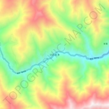
Name: 沙石多乡 topographic map, elevation, terrain.
Location: 沙石多乡, 黑水县, 阿坝藏族羌族自治州, 四川省, 中国 (32.06441 102.77023 32.14441 102.85023)
Average elevation: 3,324 m
Minimum elevation: 2,540 m
Maximum elevation: 4,346 m
Other topographic maps
Click on a map to view its topography, its elevation and its terrain.