
黑水县 topographic map
Interactive map
Click on the map to display elevation.
About this map
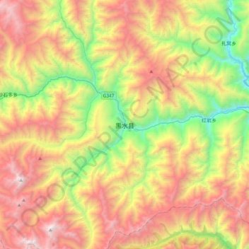
Name: 黑水县 topographic map, elevation, terrain.
Location: 黑水县, 阿坝藏族羌族自治州, 四川省, 623500, 中国 (31.90505 102.82758 32.22505 103.14758)
Average elevation: 3,484 m
Minimum elevation: 2,063 m
Maximum elevation: 5,179 m
Other topographic maps
Click on a map to view its topography, its elevation and its terrain.