
Caloundra topographic map
Click on the map to display elevation.
Caloundra
Caloundra, located on Queensland's Sunshine Coast, features a diverse coastal topography characterized by sandy beaches, rocky headlands, and nearby elevated terrains. The suburb of Kings Beach exemplifies this diversity, with its sandy shoreline to the south and southeast, and a rocky headland rising to about 20 meters (66 feet) to the north and northeast. The area is generally hilly, with elevations reaching over 40 meters (131 feet) in certain parts. To the west, the Mooloolah River flows eastward across Glenview towards the coast, with nearby elevations such as Meridan Hill at 140 meters (459 feet) and Mount Sippy at 180 meters (591 feet). Further southwest, Mount Mellum rises to 406 meters (1,332 feet), adding to the region's varied terrain. Additionally, the Pumicestone Passage, a narrow waterway between Bribie Island and the mainland, extends from Caloundra southward for about 35 kilometers (22 miles), contributing to the area's intricate coastal landscape.
About this map
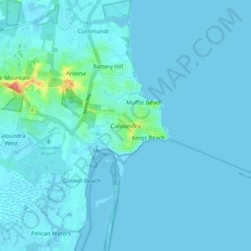
Name: Caloundra topographic map, elevation, terrain.
Location: Caloundra, Queensland, 4551, Australia (-26.83816 153.09544 -26.75816 153.17544)
Average elevation: 5 m
Minimum elevation: -4 m
Maximum elevation: 73 m
Other topographic maps
Click on a map to view its topography, its elevation and its terrain.
City of Brisbane
Brisbane's topography is characterized by a series of hills and ranges that define its landscape. The city is situated on a low-lying floodplain, with the Brisbane River meandering through its heart, creating a winding course with many steep curves from the southwest to its mouth at Moreton Bay in the east.…
Average elevation: 71 m
Warwick
Warwick experiences an altitude-influenced humid subtropical climate (Köppen: Cfa), with hot summers and mild, relatively dry winters with cold nights. Annual precipitation averages 662.4 millimetres (26.08 in), with a summer maximum. The town is slightly cooler and less humid than the proximate southeast…
Average elevation: 474 m
Brisbane River
The RAAF also perform a practice session in the days preceding the event, serving as an opportunity to both practice beforehand and also promote Riverfire. One of the most popular RAAF aircraft to perform at Riverfire was the F-111 which was known for performing a 'dump-and-burn' above the city. The final…
Average elevation: 235 m
Great Sandy Strait
There are numerous named and unnamed islands in the strait. The named island are from north to south: Big Woody Island, Round Island, Little Woody Island, Picnic Island, Duck Island, Walsh Island, Turkey Island, Bookar Island, Thomas Island, Slain Island, Tooth Island, Round Bush Island, New Island, Garden…
Average elevation: 28 m
Bribie Island
Australia > Queensland > Brisbane
Bribie Island, located in Queensland, Australia, is a low-lying, elongated landmass stretching approximately 34 kilometers (21 miles) in length and up to 8 kilometers (5 miles) at its widest point. Composed predominantly of coastal sand plains, the island features two large, low-lying dunes extending…
Average elevation: 6 m
Sunshine Coast Regional
The Sunshine Coast Regional area in Queensland, Australia, features a diverse topography that ranges from coastal plains to rugged hinterlands. Along the coastline, the terrain is predominantly flat, with average elevations around 20 meters (66 feet) above sea level. Inland, the landscape transitions to…
Average elevation: 56 m
Roma
Roma experiences a humid subtropical climate (Köppen: Cfa, Trewartha: Cfal); with hot summers with moderate rains; warm to hot, relatively dry springs and autumns; and mild, dry winters. Its location on the far south of the Carnarvon Range at an elevation of 299 metres above sea level means that it is cooler…
Average elevation: 315 m
Mount Coot-tha
Australia > Queensland > City of Brisbane
It is often claimed that Mount Coot-tha is the "highest point in Brisbane", but, as the elevations above show, the peak known as Mount Coot-tha is not even the highest peak of the mountain as a whole with both Constitution Hill and The Summit being higher. However, Mount Coot-tha has a lookout with unobscured…
Average elevation: 88 m
Lama Lama National Park (Cape York Peninsula Aboriginal Land)
Average elevation: 86 m
Herbert River
With its headwaters forming at an elevation of 1,070 metres (3,510 ft) on the Atherton Tableland, part of the Great Dividing Range west of Herberton and north of Ravenshoe, the Herbert River is formed by the confluence of the Millstream and the Wild River. The Herbert River flows in a generally southeastern…
Average elevation: 458 m