
树窝乡 topographic map
Interactive map
Click on the map to display elevation.
About this map
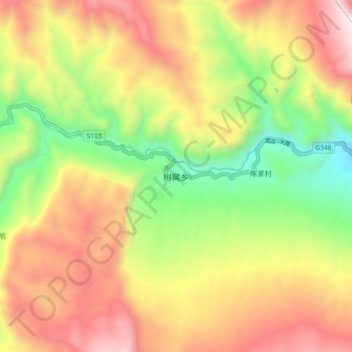
Name: 树窝乡 topographic map, elevation, terrain.
Location: 树窝乡, 美姑县, 凉山彝族自治州, 四川省, 中国 (28.72100 103.20348 28.80100 103.28348)
Average elevation: 2,106 m
Minimum elevation: 1,432 m
Maximum elevation: 2,805 m
Other topographic maps
Click on a map to view its topography, its elevation and its terrain.