
La Sarte à Ben topographic map
Interactive map
Click on the map to display elevation.
About this map
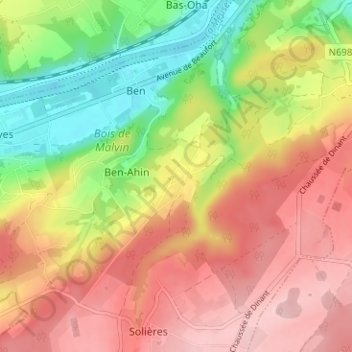
Name: La Sarte à Ben topographic map, elevation, terrain.
Location: La Sarte à Ben, Hoei, Luik, Wallonië, 4500, België (50.48292 5.16626 50.52292 5.20626)
Average elevation: 173 m
Minimum elevation: 64 m
Maximum elevation: 266 m
Other topographic maps
Click on a map to view its topography, its elevation and its terrain.