
Thank you for supporting this site ❤️
Make a donation
Make a donation
Solières topographic map
Click on the map to display elevation.
Thank you for supporting this site ❤️
Make a donation
Make a donation
About this map
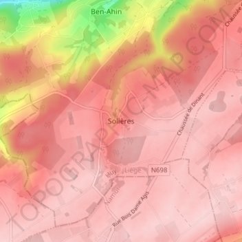
Name: Solières topographic map, elevation, terrain.
Location: Solières, Hoei, Luik, Wallonië, 4500, België (50.46522 5.16122 50.50522 5.20122)
Average elevation: 228 m
Minimum elevation: 76 m
Maximum elevation: 269 m
Thank you for supporting this site ❤️
Make a donation
Make a donation