
辽源市 topographic map
Interactive map
Click on the map to display elevation.
About this map
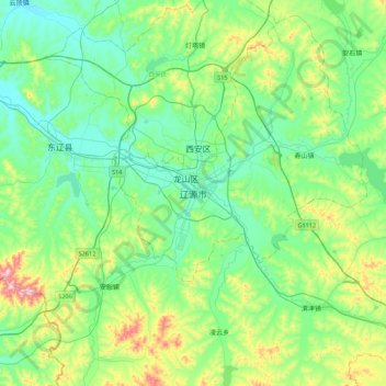
Name: 辽源市 topographic map, elevation, terrain.
Location: 辽源市, 龙山区, 辽源市, 吉林省, 中国 (42.72638 124.97749 43.04638 125.29749)
Average elevation: 323 m
Minimum elevation: 230 m
Maximum elevation: 616 m
地理座標為東經124°56′至125°50′,北緯42°18′至43°15′,为丘陵地区,地势由东向西倾,為長白山餘脈與松遼平原過渡地帶,屬低山丘陵區,平均海拔為250至400公尺。属半湿润的温带季风气候,年降水量750毫米,年均温4.5℃,1月均温−17.9℃,7月均温22.8℃。
Other topographic maps
Click on a map to view its topography, its elevation and its terrain.