
Thank you for supporting this site ❤️
Make a donation
Make a donation
West Liberty topographic map
Click on the map to display elevation.
Thank you for supporting this site ❤️
Make a donation
Make a donation
About this map
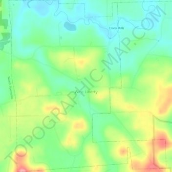
Name: West Liberty topographic map, elevation, terrain.
Location: West Liberty, Butler County, Pennsylvania, United States (40.98982 -80.07446 41.02656 -80.02988)
Average elevation: 379 m
Minimum elevation: 339 m
Maximum elevation: 447 m
Thank you for supporting this site ❤️
Make a donation
Make a donation
Other topographic maps
Click on a map to view its topography, its elevation and its terrain.
Thank you for supporting this site ❤️
Make a donation
Make a donation
Thank you for supporting this site ❤️
Make a donation
Make a donation
Thank you for supporting this site ❤️
Make a donation
Make a donation
Petersville
United States > Pennsylvania > Butler County > Connoquenessing > Petersville
Average elevation: 368 m
Thank you for supporting this site ❤️
Make a donation
Make a donation