
Thank you for supporting this site ❤️
Make a donation
Make a donation
Glen Eden topographic map
Click on the map to display elevation.
Thank you for supporting this site ❤️
Make a donation
Make a donation
About this map
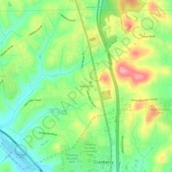
Name: Glen Eden topographic map, elevation, terrain.
Average elevation: 350 m
Minimum elevation: 297 m
Maximum elevation: 428 m
Thank you for supporting this site ❤️
Make a donation
Make a donation
Other topographic maps
Click on a map to view its topography, its elevation and its terrain.
Fernway
United States > Pennsylvania > Butler County > Cranberry Township > Fernway
Average elevation: 331 m