Geolocate
👉 Easily get elevation data in JSON, GeoTIFF and KML formats using Elevation API
Thank you for supporting this site ❤️
Make a donation

Calabogie topographic map

Click on the map to display elevation.

👉 Easily get elevation data in JSON, GeoTIFF and KML formats using Elevation API
Thank you for supporting this site ❤️
Make a donation

About this map

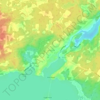
Name: Calabogie topographic map, elevation, terrain.

Location: Calabogie, Greater Madawaska, Renfrew County, Eastern Ontario, Ontario, K0J 1H0, Canada (45.28218 -76.74577 45.32218 -76.70577)

Average elevation: 163 m

Minimum elevation: 141 m

Maximum elevation: 184 m

Other topographic maps

Click on a map to view its topography, its elevation and its terrain.

Green Lake

Canada > Ontario > Renfrew County > Greater Madawaska

Average elevation: 294 m

Pike Lake

Canada > Ontario > Renfrew County > Greater Madawaska

Average elevation: 211 m

Norway Lake

Canada > Ontario > Renfrew County > Greater Madawaska

Average elevation: 169 m

Hurds Lake

Canada > Ontario > Renfrew County > Greater Madawaska

Average elevation: 194 m

Brule Lake

Canada > Ontario > Renfrew County > Greater Madawaska

Average elevation: 351 m