
Khan Tengri topographic map
Interactive map
Click on the map to display elevation.
About this map
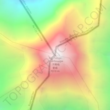
Name: Khan Tengri topographic map, elevation, terrain.
Location: Khan Tengri, Gebiet Yssykköl, Kirgisistan (42.21079 80.17435 42.21089 80.17445)
Average elevation: 5,894 m
Minimum elevation: 4,775 m
Maximum elevation: 6,978 m
Other topographic maps
Click on a map to view its topography, its elevation and its terrain.
Yssykköl
Yssykköl, Gebiet Yssykköl, Kirgisistan
Average elevation: 2,589 m