
Beni Yagoub topographic map
Interactive map
Click on the map to display elevation.
About this map
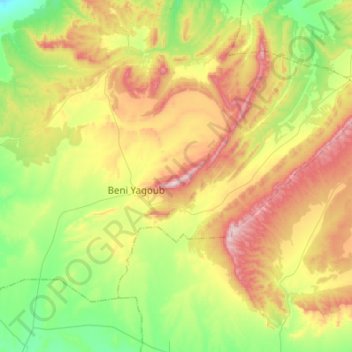
Name: Beni Yagoub topographic map, elevation, terrain.
Location: Beni Yagoub, Daïra Charef, Djelfa, Algérie (34.39644 2.70196 34.55720 2.97483)
Average elevation: 1,306 m
Minimum elevation: 1,100 m
Maximum elevation: 1,609 m
Other topographic maps
Click on a map to view its topography, its elevation and its terrain.
Charef
Algérie > Djelfa > Daïra Charef
Charef, Daïra Charef, Djelfa, 17015, Algérie
Average elevation: 1,182 m
El Guedid
Algérie > Djelfa > Daïra Charef > El Guedid
El Guedid, Daïra Charef, Djelfa, Algérie
Average elevation: 1,012 m