
Thank you for supporting this site ❤️
Make a donation
Make a donation
Colinton topographic map
Click on the map to display elevation.
Thank you for supporting this site ❤️
Make a donation
Make a donation
About this map
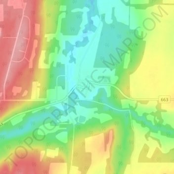
Name: Colinton topographic map, elevation, terrain.
Location: Colinton, Athabasca County, Alberta, T0G 0R0, Canada (54.60077 -113.27024 54.64077 -113.23024)
Average elevation: 584 m
Minimum elevation: 532 m
Maximum elevation: 654 m
Thank you for supporting this site ❤️
Make a donation
Make a donation
Other topographic maps
Click on a map to view its topography, its elevation and its terrain.