
Little River Canyon National Preserve topographic map
Interactive map
Click on the map to display elevation.
About this map
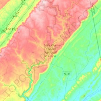
Name: Little River Canyon National Preserve topographic map, elevation, terrain.
Average elevation: 328 m
Minimum elevation: 172 m
Maximum elevation: 545 m
Other topographic maps
Click on a map to view its topography, its elevation and its terrain.
Desoto State Park
United States > Alabama > DeKalb County > Fort Payne
Desoto State Park, Fort Payne, DeKalb County, Alabama, United States
Average elevation: 454 m
Minvale
United States > Alabama > DeKalb County > Fort Payne > Minvale
Minvale, Fort Payne, DeKalb County, Alabama, 35967, United States
Average elevation: 322 m
Fort Payne
United States > Alabama > DeKalb County > Fort Payne
Fort Payne, DeKalb County, Alabama, 35967, United States
Average elevation: 350 m