
Ikhlidjen topographic map
Interactive map
Click on the map to display elevation.
About this map
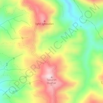
Name: Ikhlidjen topographic map, elevation, terrain.
Location: Ikhlidjen, Guenzet, Daïra Guenzet, Sétif, Algérie (36.33487 4.83119 36.35487 4.85119)
Average elevation: 822 m
Minimum elevation: 632 m
Maximum elevation: 1,036 m
Other topographic maps
Click on a map to view its topography, its elevation and its terrain.
Timenguache
Algérie > Sétif > Daïra Guenzet > Guenzet
Timenguache, Guenzet, Daïra Guenzet, Sétif, Algérie
Average elevation: 1,106 m
Ighil Lekhmis
Algérie > Sétif > Daïra Guenzet > Guenzet > Ighil Lekhmis
Ighil Lekhmis, Guenzet, Daïra Guenzet, Sétif, Algérie
Average elevation: 1,011 m