
乾州街道 topographic map
Interactive map
Click on the map to display elevation.
About this map
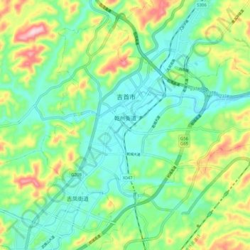
Name: 乾州街道 topographic map, elevation, terrain.
Location: 乾州街道, 吉首市, 湘西土家族苗族自治州, 湖南省, 中国 (28.21580 109.65950 28.29413 109.76047)
Average elevation: 275 m
Minimum elevation: 175 m
Maximum elevation: 501 m
Other topographic maps
Click on a map to view its topography, its elevation and its terrain.