
矮寨镇 topographic map
Interactive map
Click on the map to display elevation.
About this map
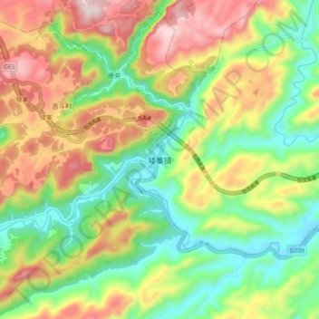
Name: 矮寨镇 topographic map, elevation, terrain.
Location: 矮寨镇, 吉首市, 湘西土家族苗族自治州, 湖南省, 中国 (28.28623 109.55452 28.36623 109.63452)
Average elevation: 494 m
Minimum elevation: 208 m
Maximum elevation: 887 m
Other topographic maps
Click on a map to view its topography, its elevation and its terrain.