
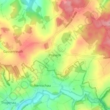
Posseck topographic map
Interactive map
Click on the map to display elevation.
About this map
Name: Posseck topographic map, elevation, terrain.
Average elevation: 571 m
Minimum elevation: 513 m
Maximum elevation: 630 m
Other topographic maps
Click on a map to view its topography, its elevation and its terrain.
Reichenbach
Deutschland > Sachsen > Vogtlandkreis
Reichenbach, Reichenbach im Vogtland, Vogtlandkreis, Sachsen, Deutschland
Average elevation: 401 m
Plauen
Deutschland > Sachsen > Vogtlandkreis
Plauen, Vogtlandkreis, Sachsen, Deutschland
Average elevation: 429 m
Adorf/Vogtland
Deutschland > Sachsen > Vogtlandkreis
Adorf/Vogtland, Vogtlandkreis, Sachsen, 08626, Deutschland
Average elevation: 531 m