
Picoto topographic map
Interactive map
Click on the map to display elevation.
About this map
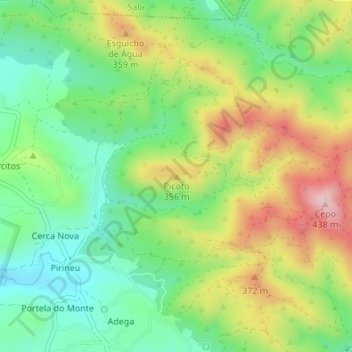
Name: Picoto topographic map, elevation, terrain.
Location: Picoto, Loulé, Faro, 8100-159, Portugal (37.21700 -7.98066 37.21710 -7.98056)
Average elevation: 269 m
Minimum elevation: 160 m
Maximum elevation: 432 m
Other topographic maps
Click on a map to view its topography, its elevation and its terrain.