
Moita Longa topographic map
Interactive map
Click on the map to display elevation.
About this map
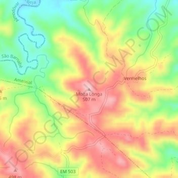
Name: Moita Longa topographic map, elevation, terrain.
Location: Moita Longa, Loulé, Faro, Portugal (37.33504 -8.02443 37.33514 -8.02433)
Average elevation: 412 m
Minimum elevation: 314 m
Maximum elevation: 502 m
Other topographic maps
Click on a map to view its topography, its elevation and its terrain.