
姑弄 topographic map
Interactive map
Click on the map to display elevation.
About this map
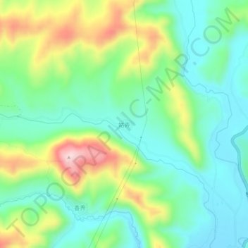
Name: 姑弄 topographic map, elevation, terrain.
Location: 姑弄, 康定市, 甘孜藏族自治州, 四川省, 626000, 中国 (30.33600 101.49659 30.37600 101.53659)
Average elevation: 3,836 m
Minimum elevation: 3,735 m
Maximum elevation: 4,047 m
Other topographic maps
Click on a map to view its topography, its elevation and its terrain.