
Patiya topographic map
Interactive map
Click on the map to display elevation.
About this map
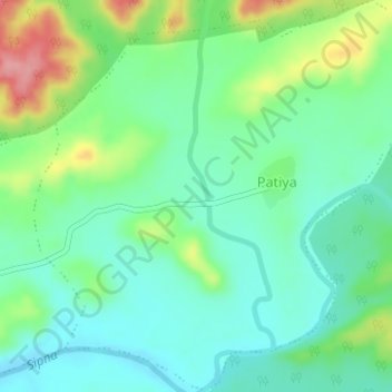
Name: Patiya topographic map, elevation, terrain.
Location: Patiya, Dharni, Amravati, Maharashtra, India (21.57847 77.03553 21.60732 77.06671)
Average elevation: 377 m
Minimum elevation: 342 m
Maximum elevation: 457 m
Other topographic maps
Click on a map to view its topography, its elevation and its terrain.
Diya
India > Maharashtra > Dharni
Diya, Dharni, Amravati, Maharashtra, 444702, India
Average elevation: 323 m
Dudhani
India > Maharashtra > Dharni
Dudhani, Dharni, Amravati, Maharashtra, India
Average elevation: 385 m