
Thank you for supporting this site ❤️
Make a donation
Make a donation
Keysville topographic map
Click on the map to display elevation.
Thank you for supporting this site ❤️
Make a donation
Make a donation
About this map
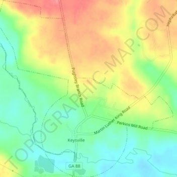
Name: Keysville topographic map, elevation, terrain.
Location: Keysville, Burke County, Georgia, United States (33.22622 -82.24817 33.25716 -82.21296)
Average elevation: 98 m
Minimum elevation: 66 m
Maximum elevation: 136 m
Thank you for supporting this site ❤️
Make a donation
Make a donation
Other topographic maps
Click on a map to view its topography, its elevation and its terrain.