Geolocate

华明街道 topographic map

Interactive map

Click on the map to display elevation.

About this map

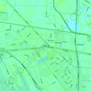
Name: 华明街道 topographic map, elevation, terrain.

Location: 华明街道, 东丽区, 天津市, 中国 (39.12412 117.35217 39.20412 117.43217)

Average elevation: 4 m

Minimum elevation: 0 m

Maximum elevation: 8 m

Other topographic maps

Click on a map to view its topography, its elevation and its terrain.

仁乐家园社区

中国 > 天津市 > 东丽区

仁乐家园社区, 东丽区, 天津市, 300301, 中国

Average elevation: 3 m

东丽湖街道

中国 > 天津市 > 东丽区

东丽湖街道, 东丽区, 天津市, 中国

Average elevation: 4 m

军粮城街道

中国 > 天津市 > 东丽区

军粮城街道, 东丽区, 天津市, 300301, 中国

Average elevation: 3 m

金钟街道

中国 > 天津市 > 东丽区

金钟街道, 东丽区, 天津市, 300000, 中国

Average elevation: 4 m

华新街道

中国 > 天津市 > 东丽区

华新街道, 东丽区, 天津市, 中国

Average elevation: 4 m