
额尔古纳市 topographic map
Interactive map
Click on the map to display elevation.
About this map
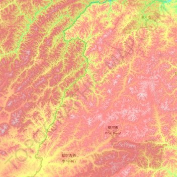
Name: 额尔古纳市 topographic map, elevation, terrain.
Average elevation: 762 m
Minimum elevation: 308 m
Maximum elevation: 1,476 m
Other topographic maps
Click on a map to view its topography, its elevation and its terrain.
巴彦淖尔市
China > Mongolia Interior > 巴彦淖尔市
巴彦淖尔市, 临河区, 巴彦淖尔市, Mongolia Interior, China
Average elevation: 1,041 m
伊金霍洛旗
China > Mongolia Interior > 伊金霍洛旗
伊金霍洛旗, Ордос / 鄂尔多斯市 / Ordos, Mongolia Interior, China
Average elevation: 1,374 m