
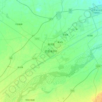
巴彦淖尔市 topographic map
Interactive map
Click on the map to display elevation.
About this map
Name: 巴彦淖尔市 topographic map, elevation, terrain.
Location: 巴彦淖尔市, 临河区, 巴彦淖尔市, Mongolia Interior, China (40.58192 107.22196 40.90192 107.54196)
Average elevation: 1,041 m
Minimum elevation: 1,033 m
Maximum elevation: 1,057 m