
Pooley Bridge topographic map
Click on the map to display elevation.
About this map
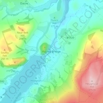
Name: Pooley Bridge topographic map, elevation, terrain.
Average elevation: 206 m
Minimum elevation: 140 m
Maximum elevation: 376 m
Other topographic maps
Click on a map to view its topography, its elevation and its terrain.
Mallerstang Edge
United Kingdom > England > Westmorland and Furness > Mallerstang
Average elevation: 489 m
River Lune
United Kingdom > England > Westmorland and Furness
The river begins as a stream at Newbiggin, in the parish of Ravenstonedale, Cumbria, at St. Helen's Well (elevation of 238 metres (781 ft) above sea level) and some neighbouring springs. On the first two miles of its course, it is joined by four streams, two of them as short as itself, but two much longer.…
Average elevation: 220 m
Dufton
United Kingdom > England > Westmorland and Furness
Dufton Ghyll Wood is an area of semi-natural ancient woodland that contains significant outcrops of St Bees Sandstone. Other local geographic features include Dufton Pike, Knock Pike, Cross Fell and High Cup. The locality is also known for the Helm Wind and Helm Bar. The latter are wind and cloud effects…
Average elevation: 387 m
Deepdale Beck
United Kingdom > England > Westmorland and Furness > South Lakeland > Dent
Average elevation: 280 m
Jack Croft's Pond
United Kingdom > England > Westmorland and Furness > Newtown
Average elevation: 217 m
Brothers Water
United Kingdom > England > Westmorland and Furness > Patterdale > Hartsop
Average elevation: 298 m
Trout Beck
United Kingdom > England > Westmorland and Furness > Troutbeck Bridge
Average elevation: 308 m
Howgill Fells
United Kingdom > England > Westmorland and Furness > Ravenstonedale
Average elevation: 303 m
Wharton Tarn
United Kingdom > England > Westmorland and Furness > Hawkshead > Hawkshead Hill
Average elevation: 173 m
Roudsea Wood
United Kingdom > England > Westmorland and Furness > South Lakeland > Haverthwaite
Average elevation: 7 m
Scout Scar
United Kingdom > England > Westmorland and Furness > Brigsteer
Scout Scar, also called Underbarrow Scar, is a hill in the English Lake District, west of Kendal, Cumbria and above the village of Underbarrow. It reaches 771 feet (235 m). Scout Scar is the subject of a chapter of Wainwright's book The Outlying Fells of Lakeland, but the summit he describes is a lower summit…
Average elevation: 130 m
River Glenderamackin
United Kingdom > England > Westmorland and Furness > Threlkeld
Average elevation: 346 m