
多伦诺尔镇 topographic map
Interactive map
Click on the map to display elevation.
About this map
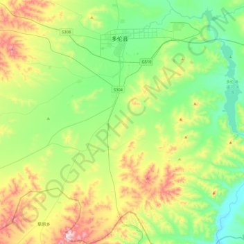
Name: 多伦诺尔镇 topographic map, elevation, terrain.
Location: 多伦诺尔镇, 多伦县, 锡林郭勒盟, 内蒙古自治区, 中国 (41.93633 116.26095 42.24772 116.66840)
Average elevation: 1,326 m
Minimum elevation: 1,150 m
Maximum elevation: 1,705 m
Other topographic maps
Click on a map to view its topography, its elevation and its terrain.