
大安源 topographic map
Interactive map
Click on the map to display elevation.
About this map
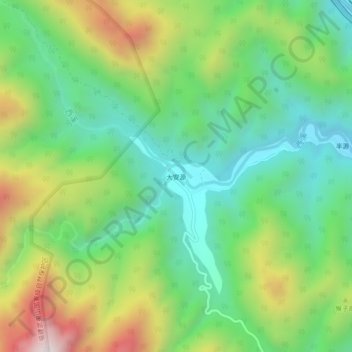
Name: 大安源 topographic map, elevation, terrain.
Location: 大安源, 武夷山市, 南平市, 福建省, 中国 (27.85417 117.83720 27.89417 117.87720)
Average elevation: 770 m
Minimum elevation: 414 m
Maximum elevation: 1,425 m
Other topographic maps
Click on a map to view its topography, its elevation and its terrain.
武夷山国家级风景名胜区
武夷山国家级风景名胜区, 武夷街道, 武夷山市, 南平市, 福建省, 354300, 中国
Average elevation: 302 m