
Hierlot topographic map
Interactive map
Click on the map to display elevation.
About this map
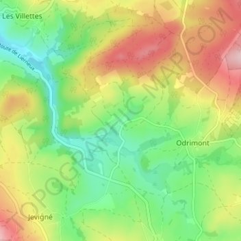
Name: Hierlot topographic map, elevation, terrain.
Location: Hierlot, Lierneux, Verviers, Liège, Wallonie, 4990, Belgique (50.29132 5.76967 50.33132 5.80967)
Average elevation: 398 m
Minimum elevation: 310 m
Maximum elevation: 518 m
Other topographic maps
Click on a map to view its topography, its elevation and its terrain.