
Karditsa topographic map
Interactive map
Click on the map to display elevation.
About this map
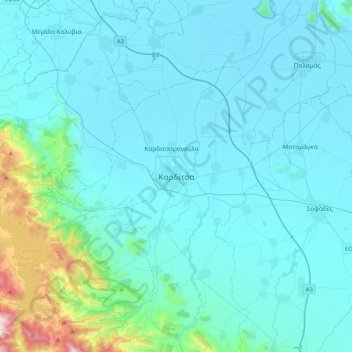
Name: Karditsa topographic map, elevation, terrain.
Average elevation: 223 m
Minimum elevation: 86 m
Maximum elevation: 1,483 m
Der Flugplatz Myrini (39.40740721.995666 ICAO: LGMY) liegt etwa sieben Kilometer nordöstlich von der Stadt Karditsa entfernt. Die asphaltierte Start- und Landebahn mit einer Ausrichtung von 09/27 ist 680 Meter lang und 20 Meter breit. Der Flugplatz liegt auf einer Höhe von 96 m (315 ft) über dem Meeresspiegel.
Other topographic maps
Click on a map to view its topography, its elevation and its terrain.
Prodromos
Griechenland > Thessalien - Mittelgriechenland > Regionalbezirk Karditsa
Prodromos, Δήμος Καρδίτσας, Regionalbezirk Karditsa, Region Thessalien, Thessalien - Mittelgriechenland, 431 00, Griechenland
Average elevation: 101 m